Skip to content
FREE SHIPPING ON ORDERS OVER $15
(0) Cart
Search
Cart (0) Cart
  • Home
  • Maps By Type Toggle menu
    • Dive Maps
    • Fish Cards
    • Guide Maps
    • Surf Maps
    • Trail Maps
    • Specialty Maps
  • Maps by Location Toggle menu
    • Maps by Location (A-I) Toggle menu
      • Alaska
      • California
      • Caribbean
      • Colorado
      • Florida
      • Hawaii
      • Idaho
      • Indonesia
    • Maps by Location (J-Z) Toggle menu
      • Japan
      • Mexico
      • Micronesia
      • Montana
      • Nevada
      • South Pacific
      • Washington
      • Wisconsin
      • Wyoming
  • Catalog
  • Contact Franko Maps
Previous / Next

California Delta Waterways Laminated Wall Map

$19.95
By Franko Maps Ltd
Minus Plus

California Delta Waterways Laminated Wall Map is backordered and will ship as soon as it is back in stock.

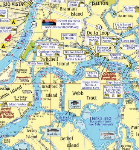
Detailed waterways map of the San Joaquin and Sacramento river. 18.5" x 26", laminated with edge seal. Ships rolled.

Side 1 shows the area from Sacramento on the north to Tracy on the south, and from Stockton on the east to Pittsburg on the west. 

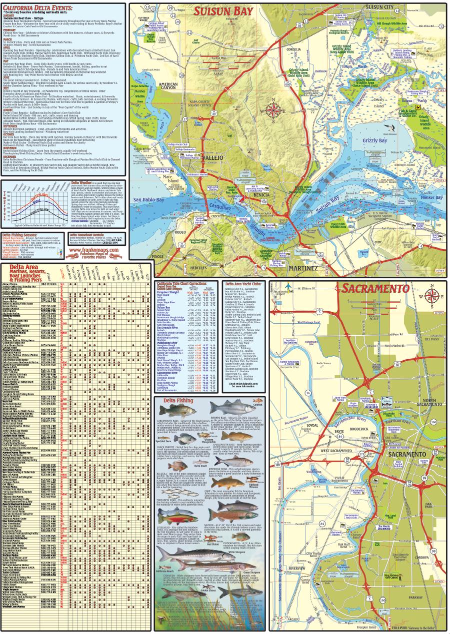
Side 2 picks up where side 1 leaves off in that it details Sacramento and it s waterways, plus the extensive waterways of Suisun Bay and beyond. 

Listings of California Delta events, Delta area marinas, resorts, boat launches and fishing piers. Tide chart corrections.

Share
  • Facebook Share on Facebook
  • Twitter Share on Twitter
  • Pinterest Pin it
Share
  • Facebook Share on Facebook
  • Twitter Share on Twitter
  • Pinterest Pin it
Left
Right
Free shipping Over $15
Custom Maps
Based in Hawaii
Contact us
  • Search
  • Shipping Policy & Store Info
  • Refund Policy
  • Contact Franko Maps
  • Privacy Policy
  • Terms of Service
© 2023 Franko Maps. Powered by Shopify
American Express Apple Pay Diners Club Discover Meta Pay Google Pay Mastercard PayPal Shop Pay Venmo Visa