Skip to content
FREE SHIPPING ON ORDERS OVER $15
(0) Cart
Search
Cart (0) Cart
  • Home
  • Maps By Type Toggle menu
    • Dive Maps
    • Fish Cards
    • Guide Maps
    • Surf Maps
    • Trail Maps
    • Specialty Maps
  • Maps by Location Toggle menu
    • Maps by Location (A-I) Toggle menu
      • Alaska
      • California
      • Caribbean
      • Colorado
      • Florida
      • Hawaii
      • Idaho
      • Indonesia
    • Maps by Location (J-Z) Toggle menu
      • Japan
      • Mexico
      • Micronesia
      • Montana
      • Nevada
      • South Pacific
      • Washington
      • Wisconsin
      • Wyoming
  • Catalog
  • Contact Franko Maps
Previous / Next
Orange County Coast Dive Map - Frankos Maps

Orange County Coast Dive Map

$7.99
By Franko Maps
Minus Plus

Orange County Coast Dive Map is backordered and will ship as soon as it is back in stock.

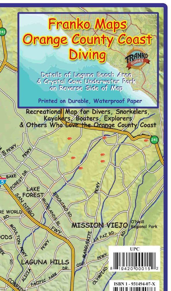
This is a map for divers, snorkelers, kayakers and boaters. 14 x 21 folded to a handy 4 x 7 printed on waterproof rip-resistant synthetic material.

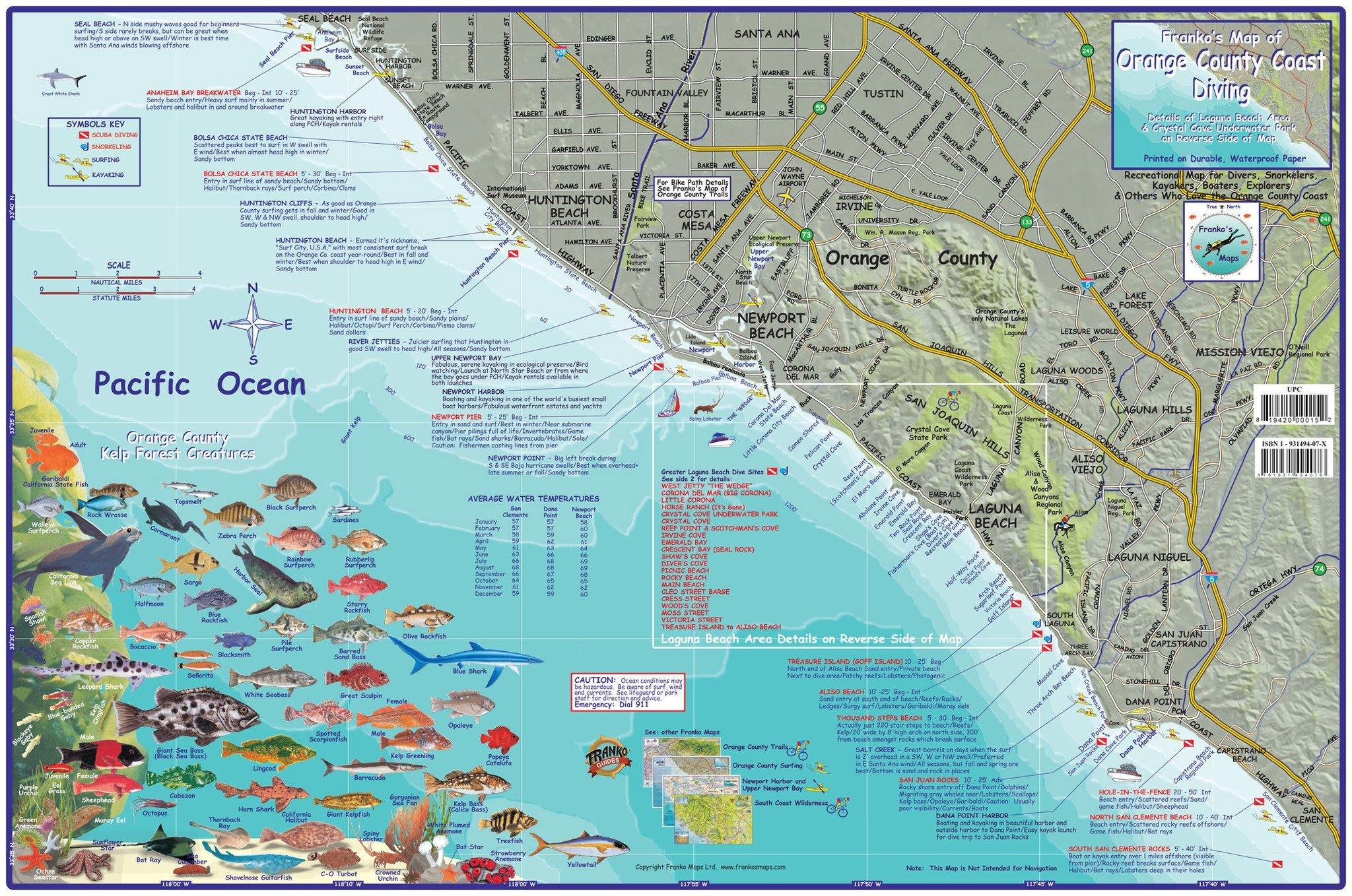
Side one features a shaded relief map of Orange County from Seal Beach to San Clemente, with the major roads and freeways to help you get to your favorite coastal spot. The ocean is shown in pleasing blue shades, which indicate descending depths. Newport Canyon, which tends to focus southerly swells into big surf near Newport Pier, can be easily recognized. Kelp Forest Creature illustrations show you what might be encountered offshore when snorkeling or scuba diving. Dive and snorkel spots all along the coast are noted and described.

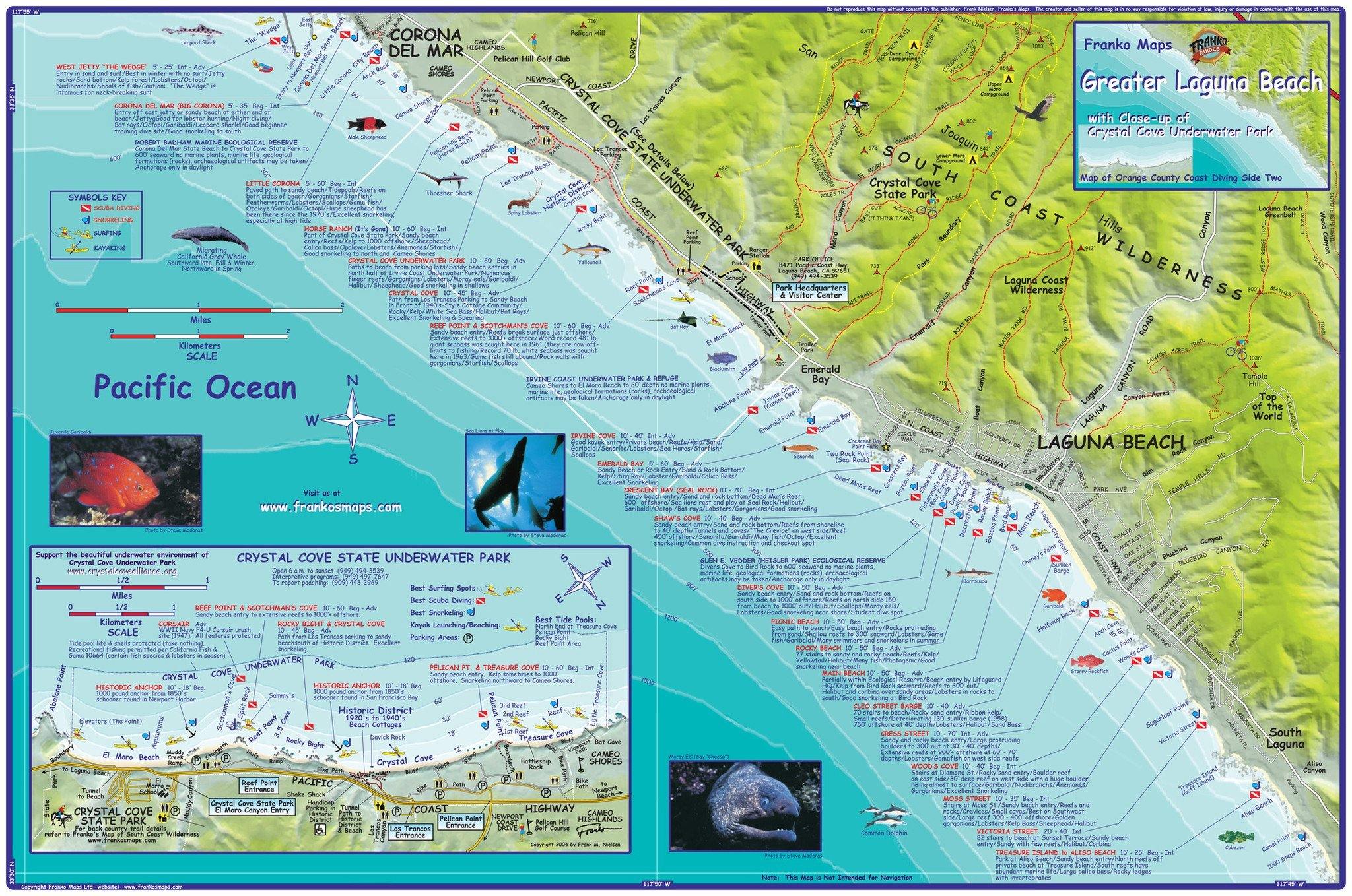
Side two is a zoom in of the middle of Orange County, with its best and favorite diving areas. This includes Corona Del Mar and Crystal Cove State Underwater Park on the North, and goes all the way through Laguna Beach to South Laguna.

The most notable dive sites, especially those around Laguna Beach, are shown and described. They include Irvine Cove, Crescent Bay & Seal Rock, Shaw's Cove, Diver's Cove, Picnic Beach, Rocky Beach, Main Beach, Cleo Street Barge, Cress Street, Wood's Cove, Moss Street, Victoria Street, and Treasure Island. The detailed coastal map is also handy for fishing or kayaking. The notable trails of Crystal Cove State Park are also shown as they follow the ridges and canyons from Moro Beach inland.

Share
  • Facebook Share on Facebook
  • Twitter Share on Twitter
  • Pinterest Pin it
Share
  • Facebook Share on Facebook
  • Twitter Share on Twitter
  • Pinterest Pin it
Left
Right
Free shipping Over $15
Custom Maps
Based in Hawaii
Contact us
  • Search
  • Shipping Policy & Store Info
  • Refund Policy
  • Contact Franko Maps
  • Privacy Policy
  • Terms of Service
© 2023 Franko Maps. Powered by Shopify
American Express Apple Pay Diners Club Discover Meta Pay Google Pay Mastercard PayPal Shop Pay Venmo Visa